As if presenting at the 2020 Multidimensional Chromatography Workshop in Hawai’i wasn’t exciting enough, Becs then had the thrill of me joining her for a bit of holiday time afterwards.
There are some obvious stereotypes which come to mind when thinking of Hawai’i, including bright sunshine and golden beaches. What awaited us at our first stop, Hilo, was a little different…
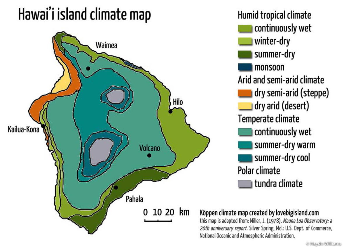
Hawai’i actually features eight out of the 13 global climate zones. This includes classifications such as “continuously wet“!
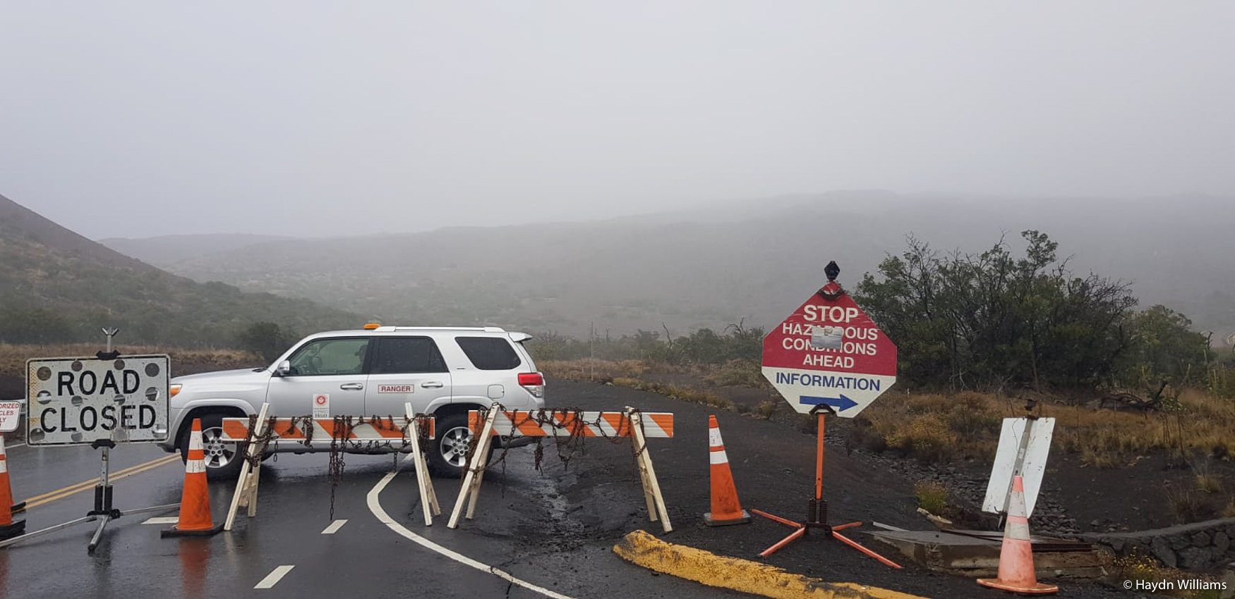
Nevertheless we continued with our plans, the first being to aim for the summit of Mauna Kea, a dormant volcano and the tallest mountain on earth from base to peak, at over 10,200 m. A hefty 4,207 m of that protrudes above sea level, meaning that if you want to drive from sea level to any of the 13 astronomical observatories at the summit then the recommendation is to stop for an hour at the visitor centre for some mini-acclimatisation! Unfortunately on the day we visited, the road above the visitor centre (2,800 m) was closed due to snow and ice.
© Haydn Williams 2020
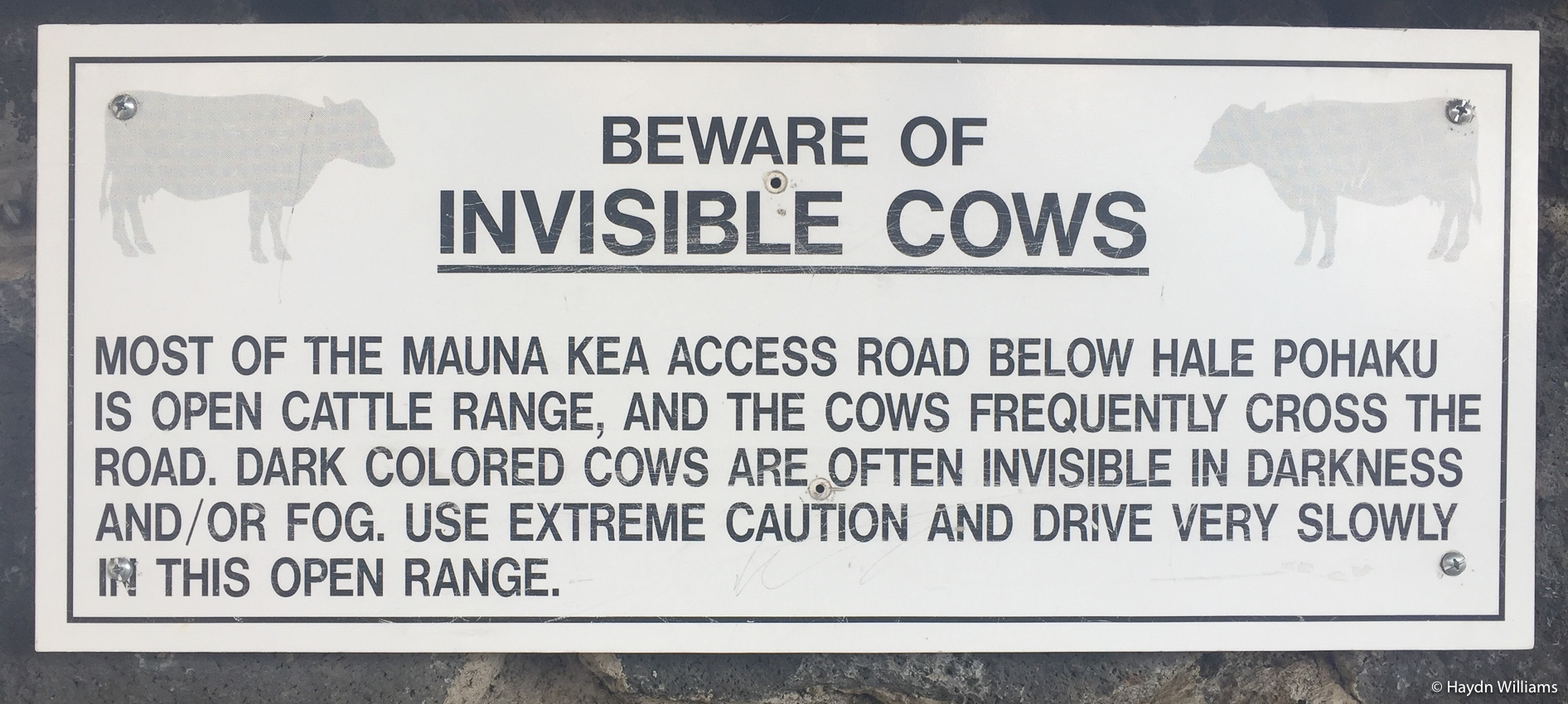
We had anticipated this, since the summit weather station read -5 ºC and the weather forecast had said “extensive fog, ice and snow flurries are likely to plague the summit through the next 5 nights“. What we hadn’t anticipated was the warning at the visitor centre regarding invisible cows…
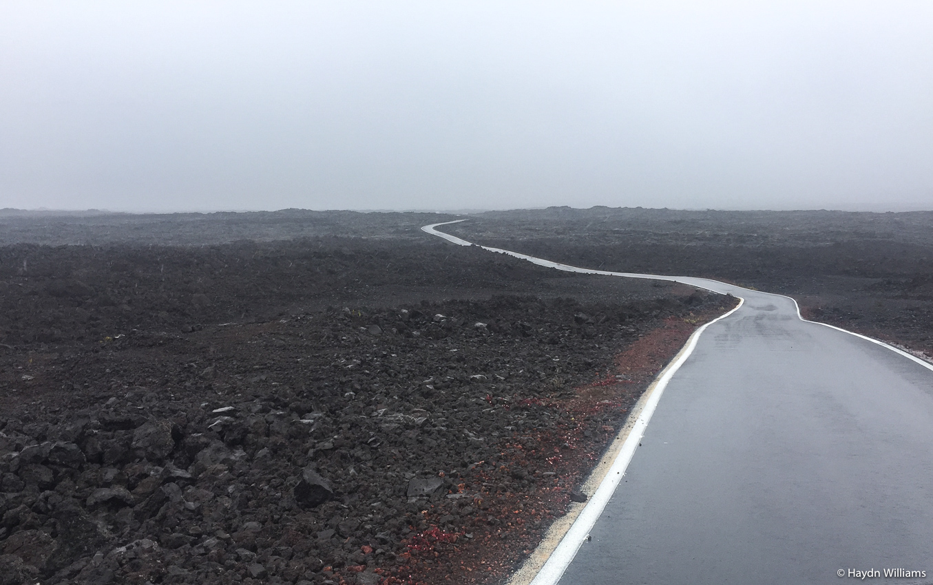
Having safety avoided the invisible cows (I guess we’ll never know just how close we came to hitting one), we tried our luck on the next-door volcano, Mauna Loa. At 4,169 m it’s another big-hitter, although its road doesn’t go quite to the top.
© Haydn Williams 2020
After ploughing through ten monotonous miles of lava field (ʻaʻā is the horrible spiky stuff; pāhoehoe is the smoother type) with no views, we called it a day and headed home, on the grounds that zero visibility at 4,100 m was fundamentally very similar to zero visibility at sea level!
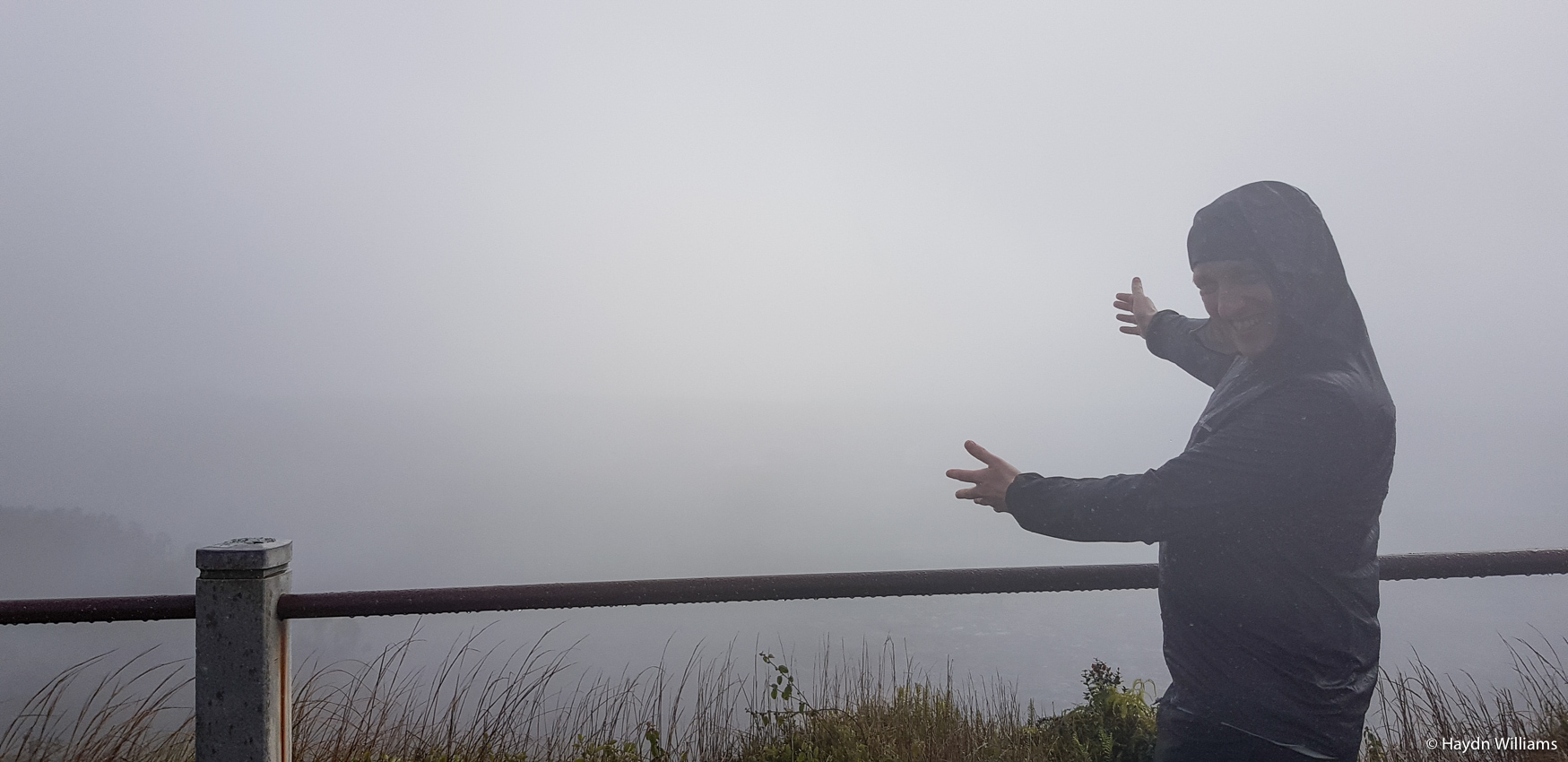
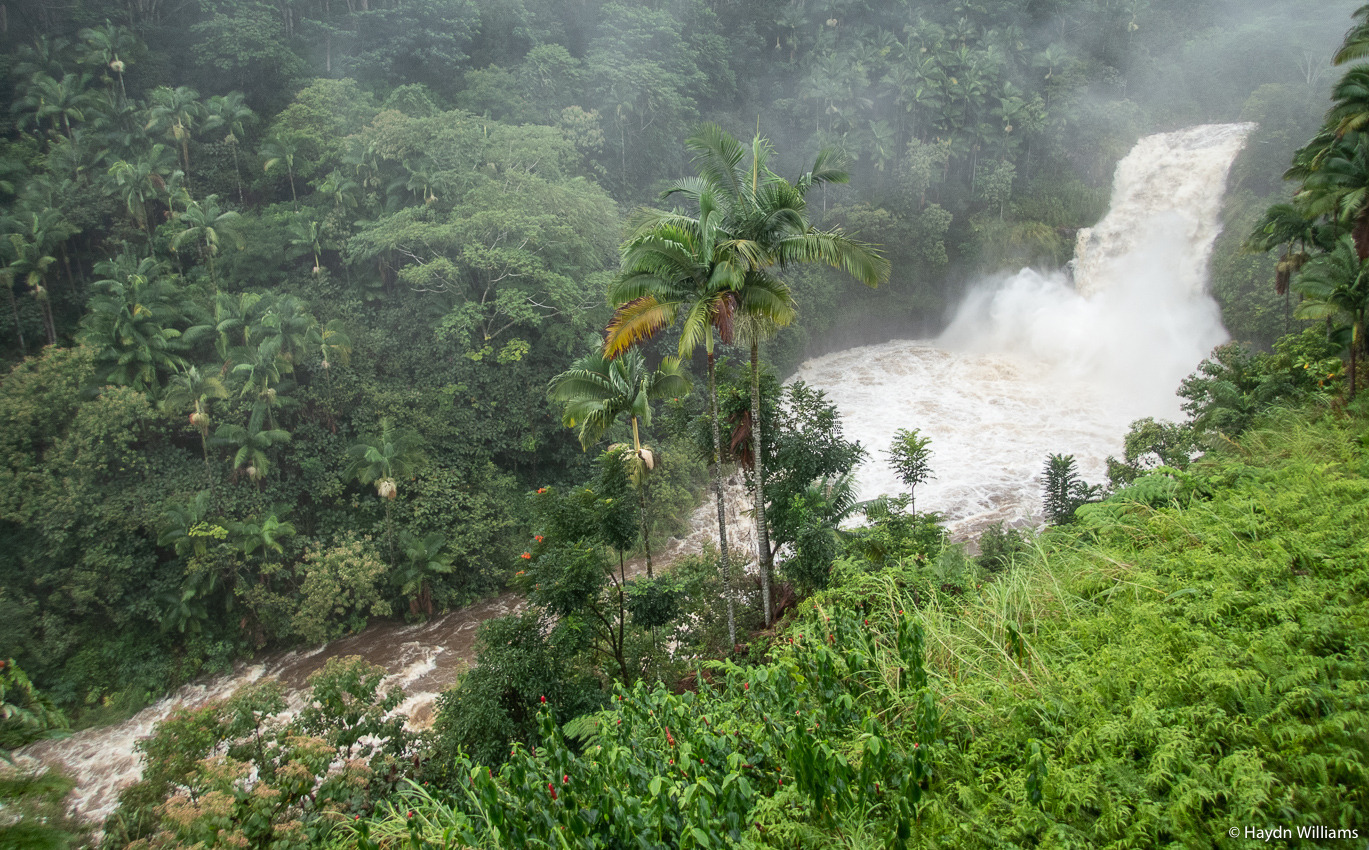
The following day had an exciting-sounding destination – Volcanoes National Park! Our travel guide book had described the possibility of looking down into a molten lava lake, and seeing molten lava flowing into the sea in a maelstrom of elemental forces! But…
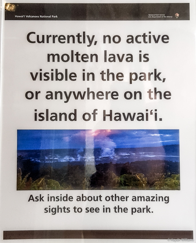
Again, we were actually prepared for this because after getting very excited reading the 2017 guidebook, I’d subsequently discovered about the huge 2018 eruption which had destroyed half of the sights and then effectively shut down volcanic activity in the park. Nevertheless, there are still plenty of bits to see, like the 1969 fissure:
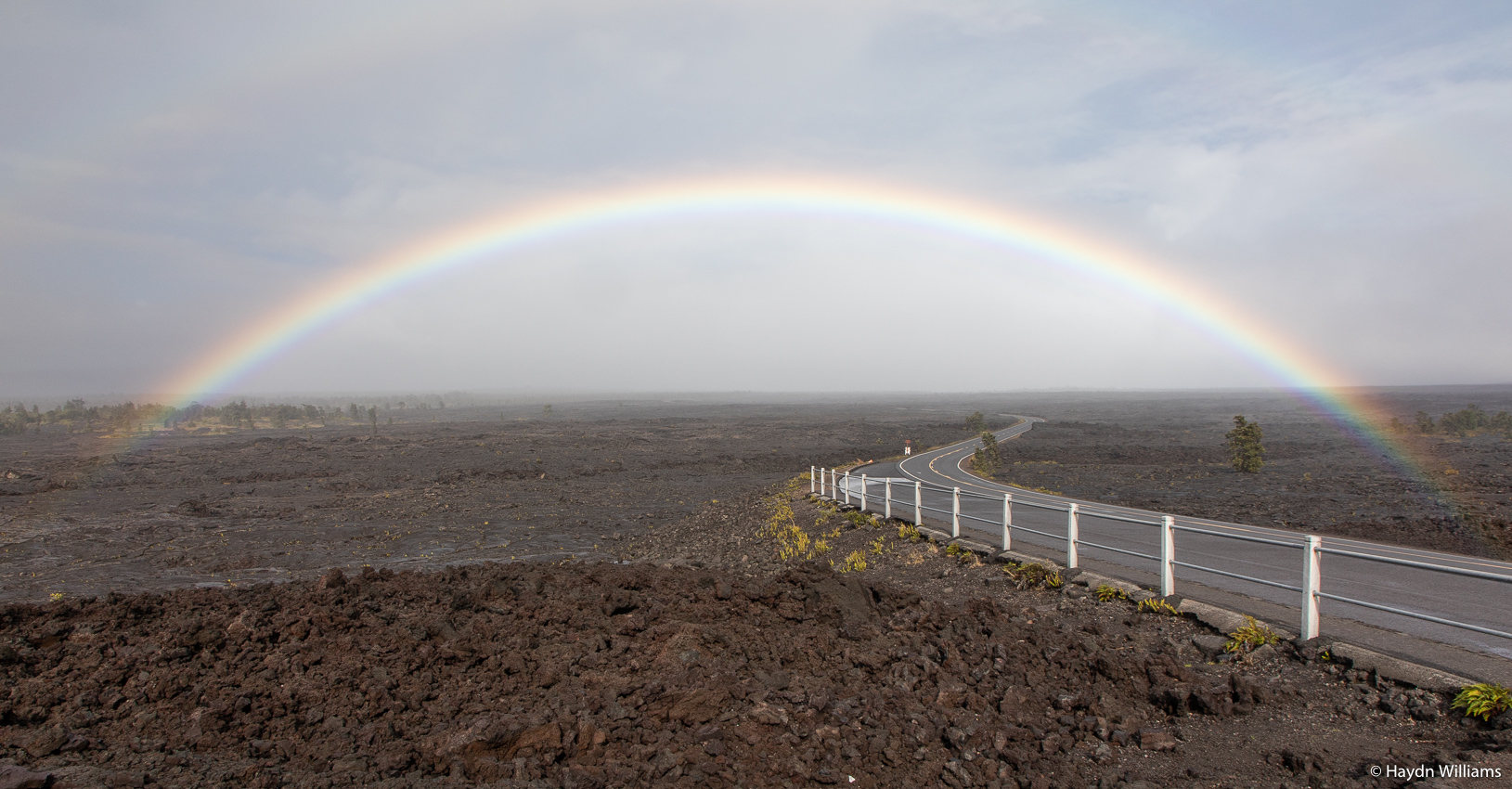
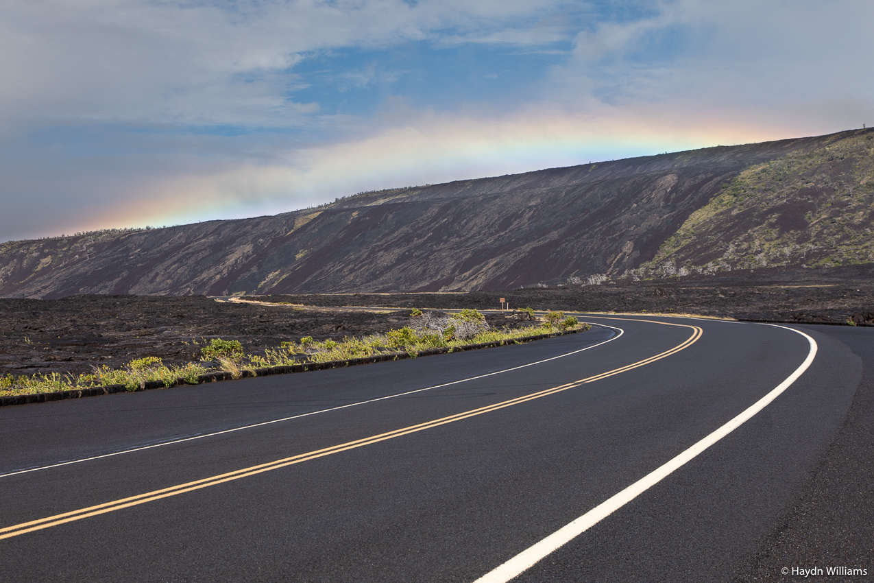
Rain continued throughout the day, meaning we were accompanied by rainbows at various intervals as we meandered across the lava fields.
As you drive towards the coast, it’s abundantly clear where lava from recent eruptions has flown downhill and over hill crests, obliterating some areas and leaving others untouched.
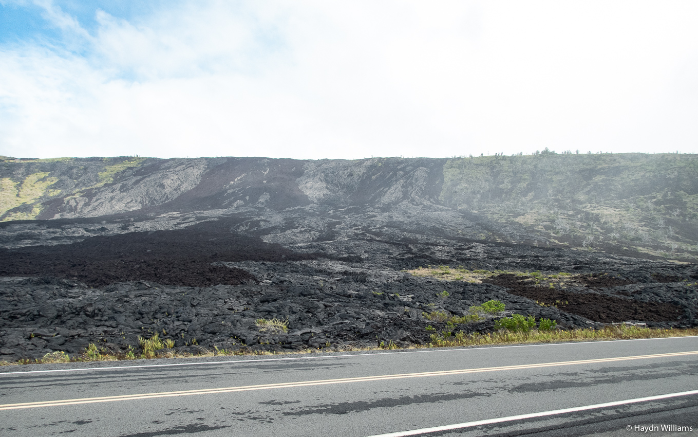
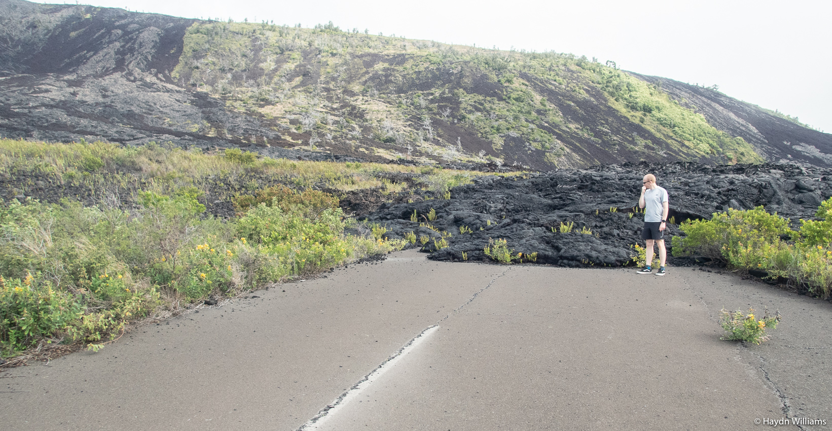
In some cases, that’s included flowing onto the road…
© Rebecca Cordell 2020
The “Chain of Craters” road was built in 1959, and has only been fully open for 13 of the intervening years – the remainder have seen some part or other closed due to being covered in lava or broken up by eruptions.
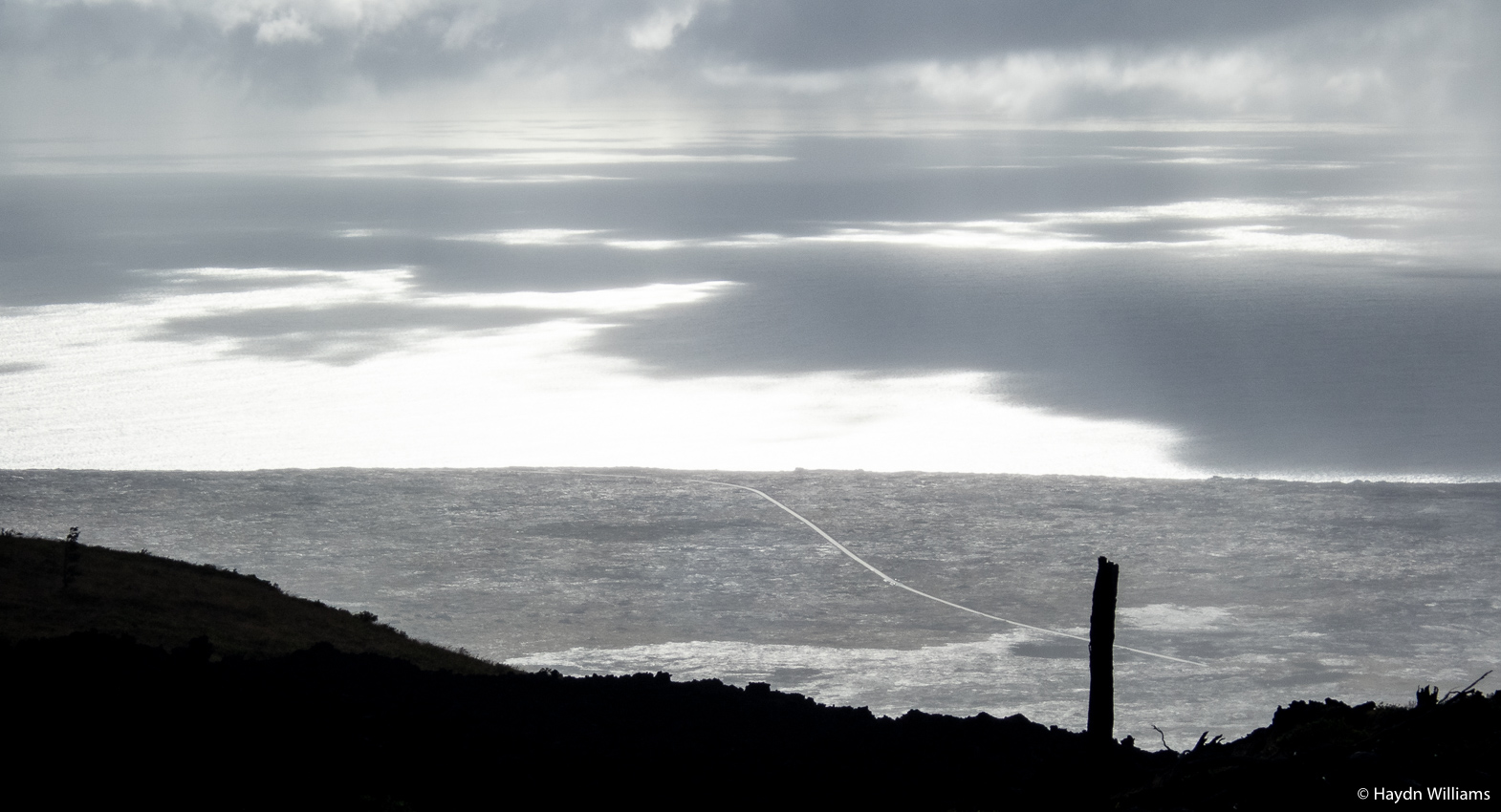
Heading further towards the sea, the road continues to cut a swathe through vast lava fields right down to the coast line.
© Haydn Williams 2020
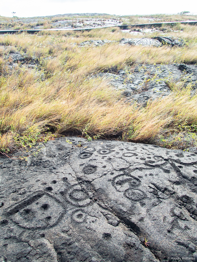
In the midst of those lava fields are the Pu’u Loa petroglyphs, featuring over 23,000 carved images and symbols. Details about the history of these are frustratingly sparse, but the lava has been dated to AD 1200-1450 (so pretty ancient, by US standards).
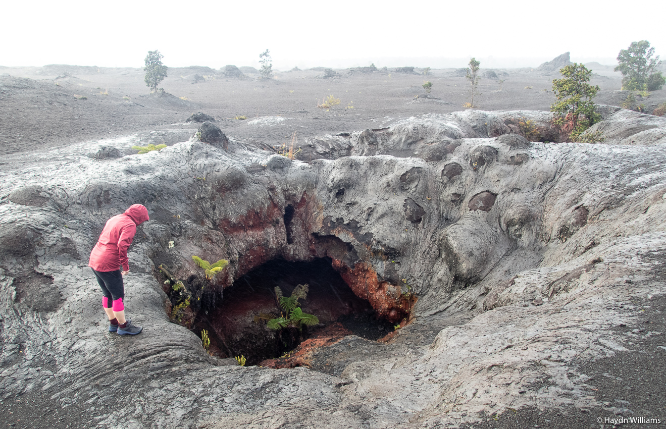
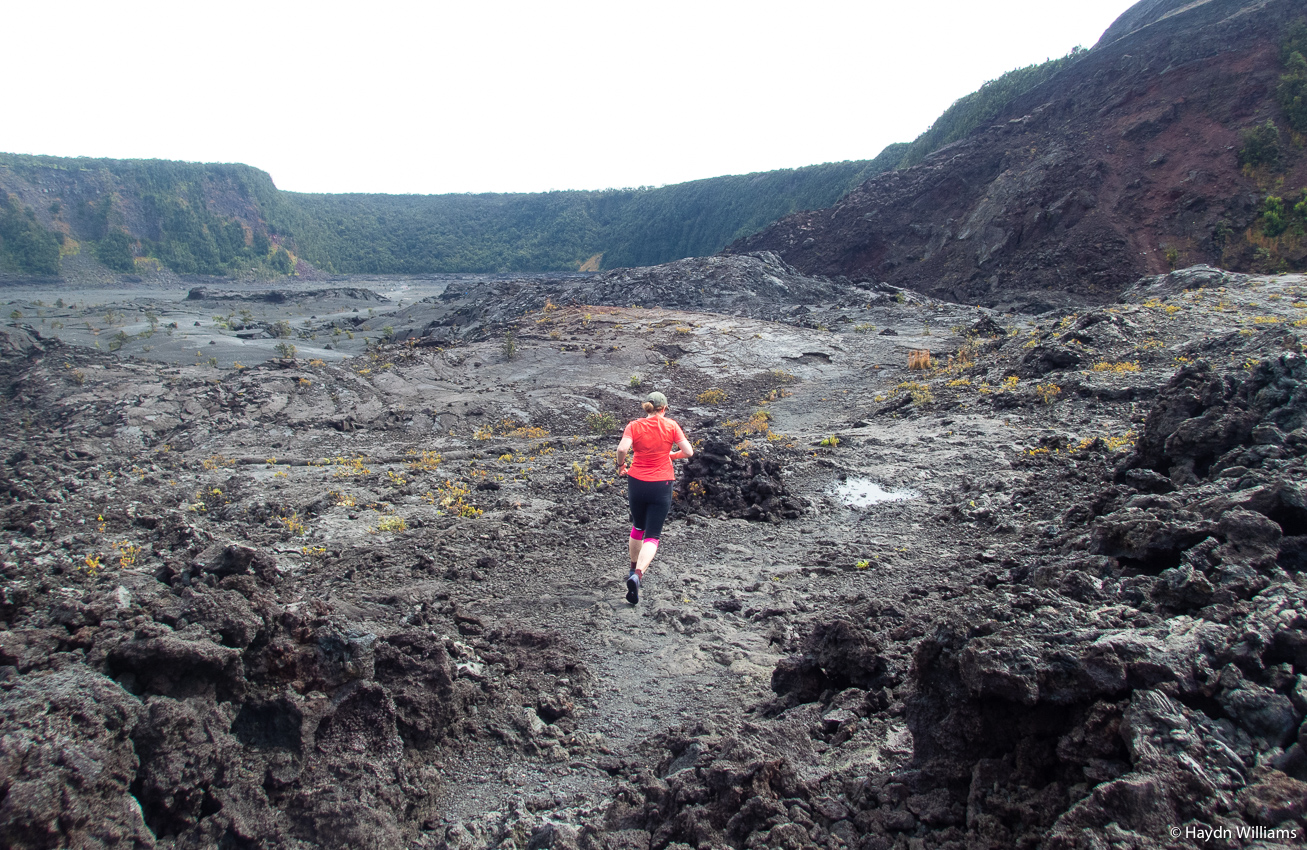
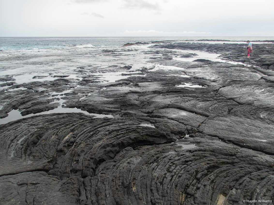
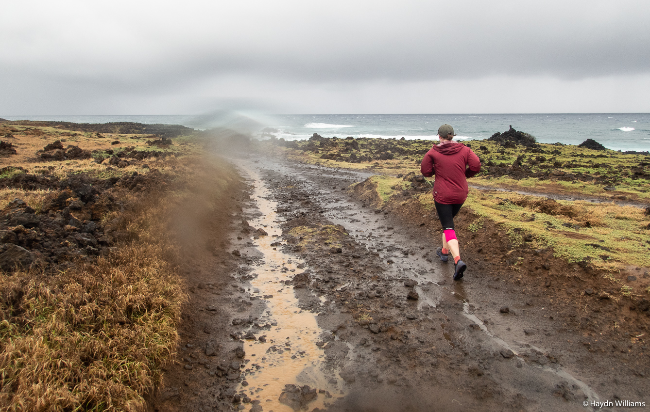
Back uphill to the main body of the park, and we took a run through the Kīlauea Iki crater. In 1959, a fissure opened in the crater and filled it with a molten lava to a depth of 120 m. It cooled over the following decades, and it’s estimated that it finally became completely solidified in the mid-1990s.
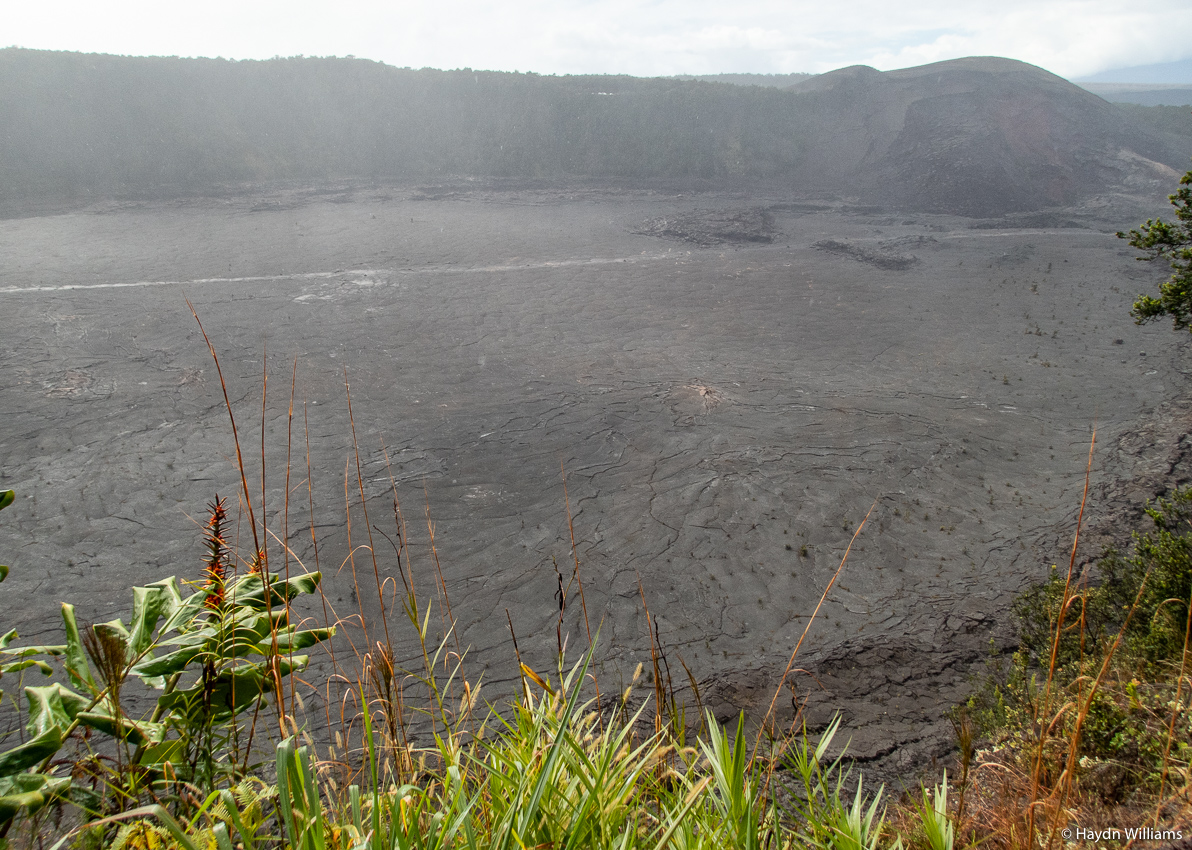
© Haydn Williams 2020
It’s still hot, though, and in wet weather the rainwater running down into cracks is soon emitted again as steam.
© Haydn Williams 2020
It should be noted that the Park is a UNESCO World Heritage site, but I’m less enthusiastic in this post than I usually am about such things because there was no logo for me to have my photo taken with (as regular readers will know is customary). Indeed, there was absolutely no mention of it anywhere in the park! Baffling, but I shall be adding it to the list anyway.
The main event in the park for many years has been the Kīlauea caldera – a boiling pool of lava forming the centrepiece of the visitor experience. The 2018 eruption saw the lava disappear, but also dramatically increased the size of the crater – I’ll think you’ll agree it’s a pretty impressive sight (!):
© Rebecca Cordell 2020
Another highlight was Sulphur Banks, which was “named by visitors”, presumably of British origin, in the 19th century. I’m pleased to report that the name remains Sulphur Banks as opposed to Sulfur Banks. To chemists reading this: I know Sulfur is the IUPAC standard, but I’m afraid I’m guilty of what Nature calls “a mistaken sense of spelling jingoism“!
Falling under the heading of “historical interest” rather than “jingoism” comes an interesting observation made whilst driving around, and of which I had previously no knowledge – the state flag of Hawai’i incorporates the Union Flag.
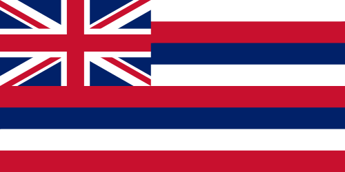
There is a long and varied reasoning behind this, but it essentially seems to be rooted in the British empire’s early contact with the islands (although post-Capt. Cook), followed by US meddling and associated British prickliness. Indeed, the entire history of Hawai’ian government, religion and statehood, and the involvement of the sugar industry, makes for very interesting reading (if a little mind-bending in complexity).
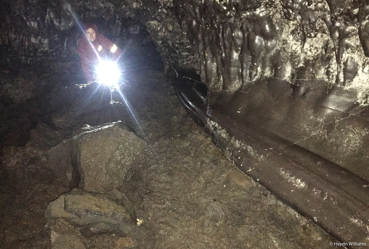
On our way home we popped into Kaumana lava tubes, which weren’t as big as the ones we saw in Iceland, but were appealing because of their complete lack of signage/lighting/handrails, and the need to crawl through a small hole with a decent torch, thus filtering out a large proportion of the other visitors about 20% of the way in!
Telly that evening consisted of the usual American dross, but was punctuated by an emergency flood warning due to the excessive levels of rain the island was receiving. As the holiday developed this turned into road closures and over 16″ of rain in one weekend.

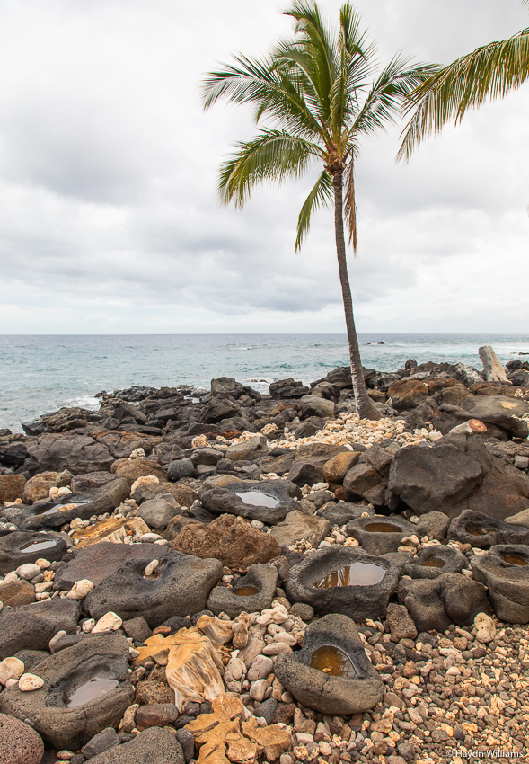
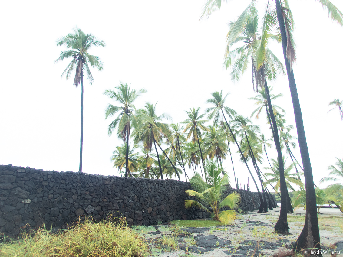
At Pu’uhonua O Hōnaunau National Historical Park we saw the huge wall which segregated a small headland on the coastline. Anyone who had broken the law but managed to reach this ‘place of refuge’ was absolved by a priest instead of receiving the usual punishment for any offence: death.
© Haydn Williams 2020
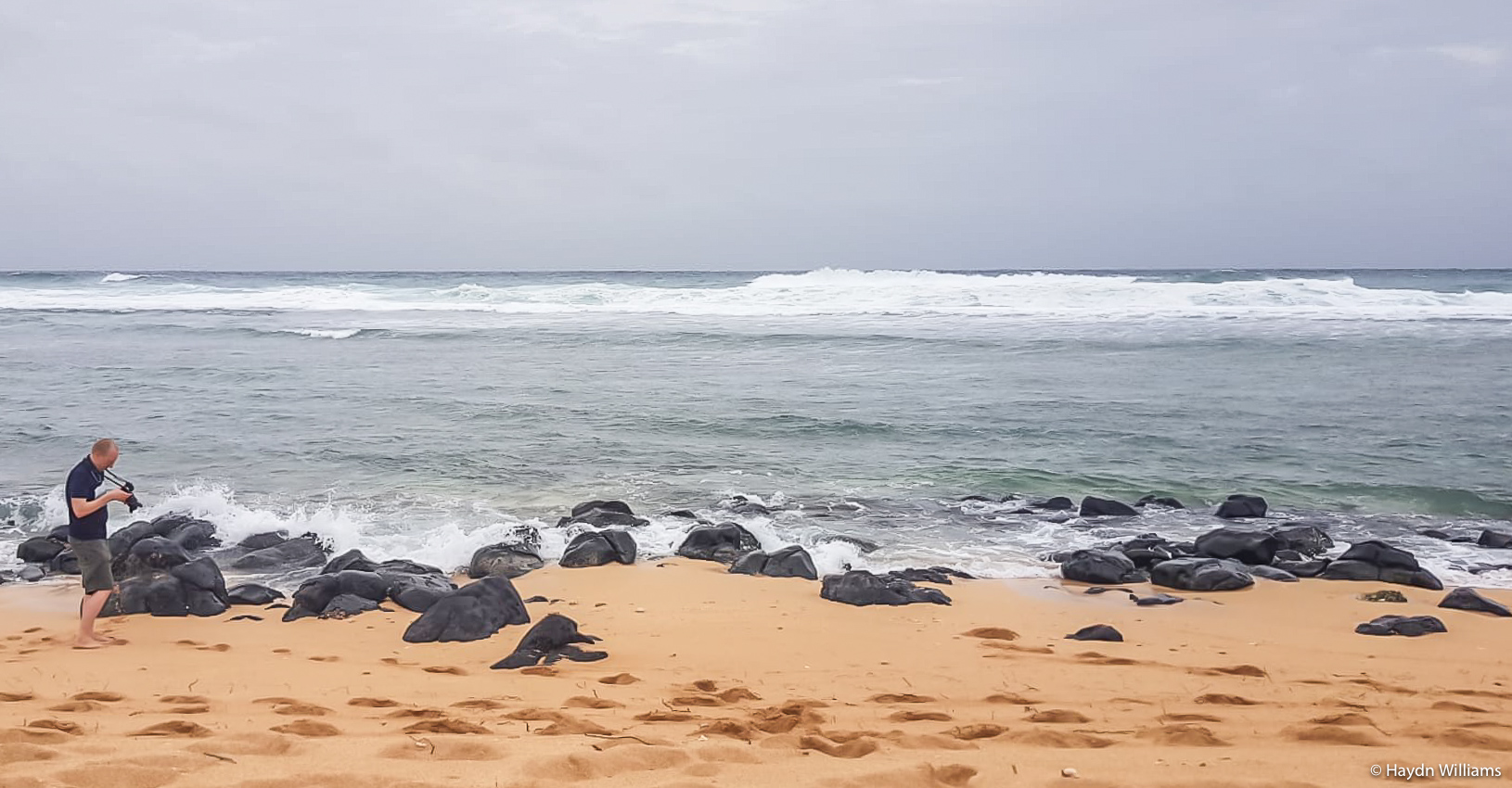
Fortunately we hadn’t broken any laws, so were free to go rock-pooling in lava flows, which was good fun. Amongst various other things we spotted an eel and a puffer fish!
© Haydn Williams 2020
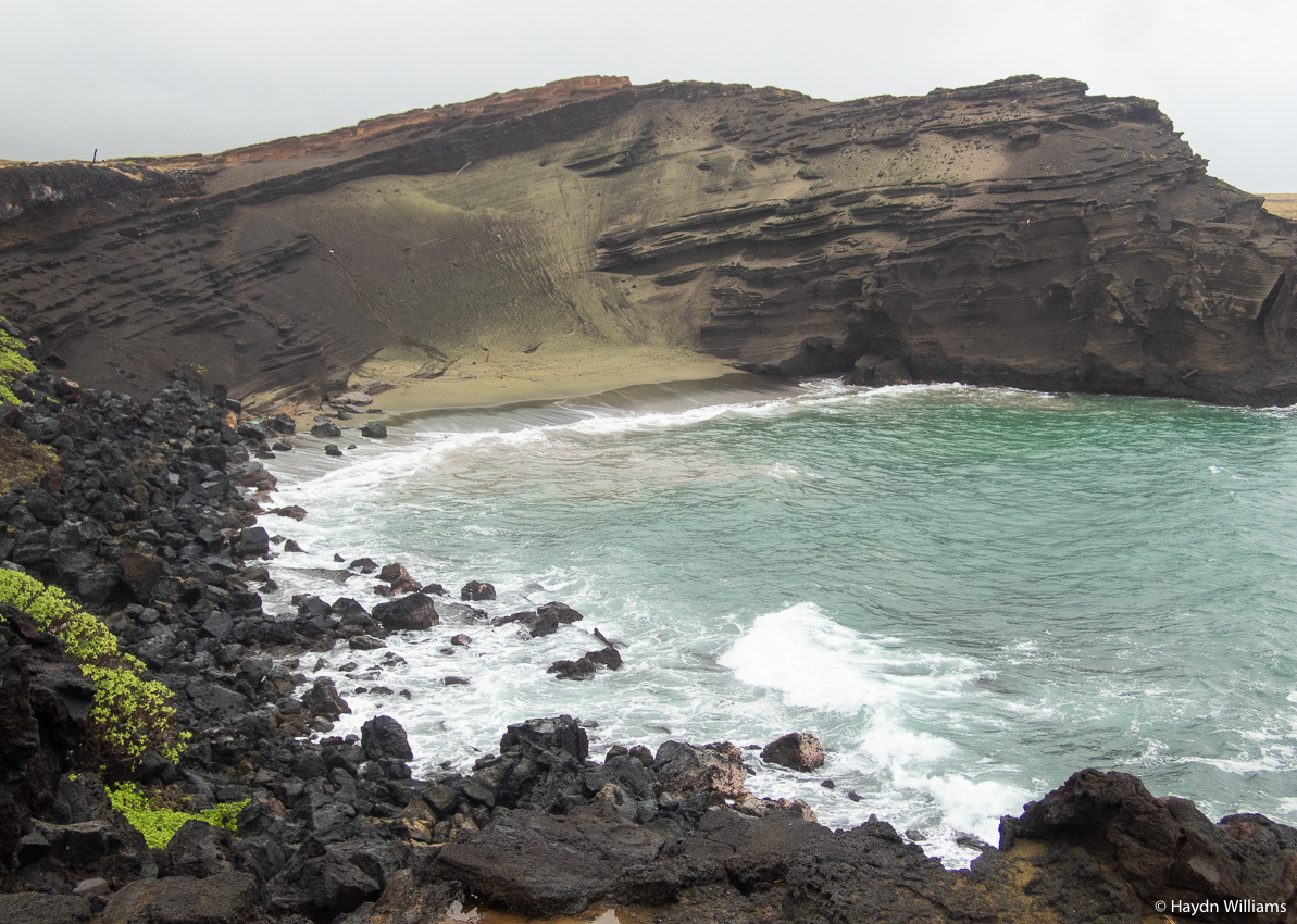
Proceeding down the coast, we drove to Ka Le, or South Point, at the tip of the Big Island – the southernmost point in the 50 states of the US. (Technically the title of “most southerly point in the entire US” goes to an incorporated US territory outwith the 50 states). We then shimmied along the coast a little, for a run out to Papakolea beach, famed for its green sand. Here’s another typical Hawai’i blue sky and baked-ground photo for you…
© Haydn Williams 2020
The green colouration is the mineral olivine, one of the first to form when lava cools. There are only four green sand beaches in the world, and whilst I wasn’t quite sure what to expect it’s actually quite noticeable when you get there.
© Haydn Wiliams 2020
A short plane hop then found us on Kauai, the most north-westerly of the main islands, and therefore the oldest (the entire island chain continually moves in a north-westerly direction away from the volcanic hotspot of formation in the south-east).
© Rebecca Cordell 2020
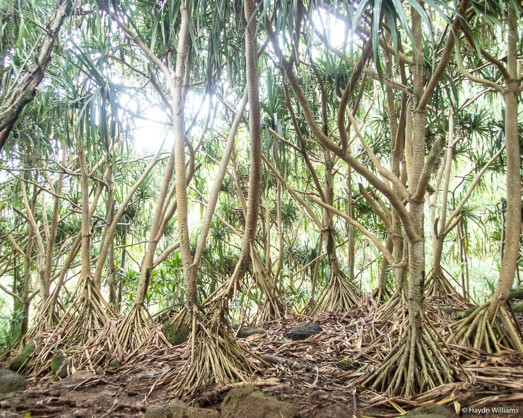
Kauai is the location of the bit I was most looking forward to – the Napali Coast. This is a rather spectacular-looking bit of coastline with many valleys eventually becoming steep fluted cliffs that bar any further access. Even getting to that point is a walking-only affair, on the Kalalau Trail. Unfortunately…

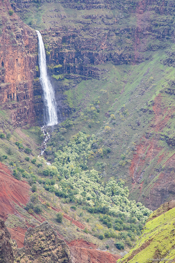
So Plan B was the Waimea valley, a huge gorge which I would never have considered as being the kind of geological feature you’d find in Hawai’i. Shows what I know!
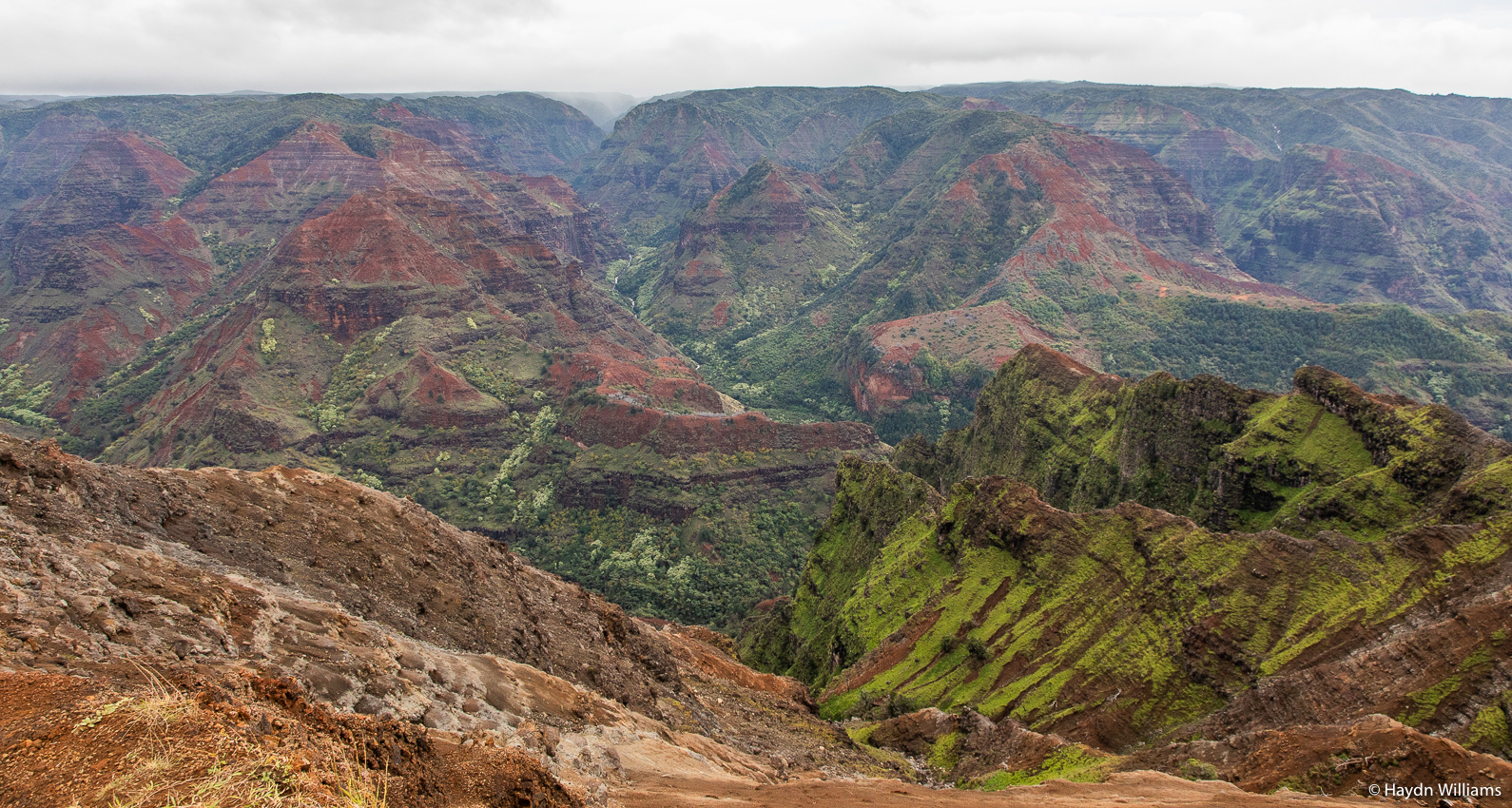
© Haydn Williams 2020
© Haydn Williams 2020
© Haydn Williams 2020
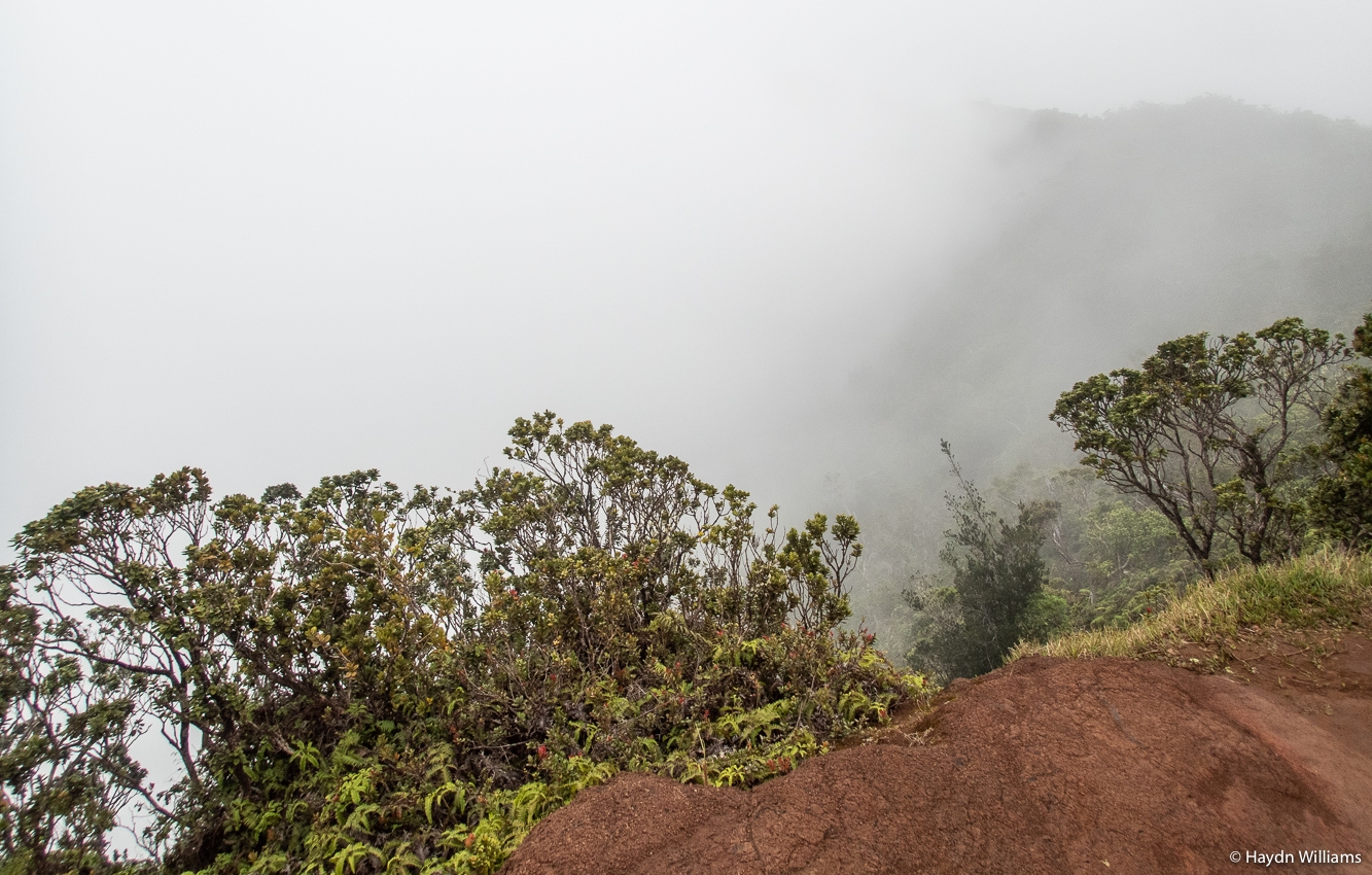
After a nice walk in the canyon we tried to see the Napali coast from the top end, i.e. looking down into the valleys towards the coast. Alas, the cloud gods were against us again.
© Haydn Williams 2020
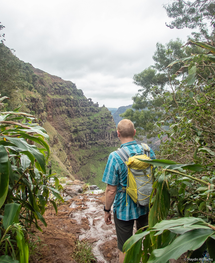
We persevered the following day and tried to access the coastal trail again by catching the 07:30 bus and found… it was still closed due to the latest overnight storms! But, as we walked back along the beach to our hotel, the website suggested it had opened again, so we caught the next bus back to the trailhead and finally got started. Woohoo!
© Haydn Williams 2020
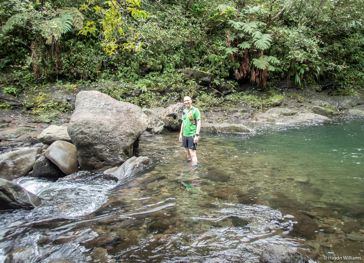
There are various restrictions on how far you can go, and innumerable warnings about not doing any of the ten river crossings if it’s too dangerous, etc. Suffice to say everything was fine, but the thick jungle was hard going and hid a lot of the views, particularly in the last two miles to our destination, Hanakapi’ai Falls.
Fortunately the main path, when rejoined, is easier going and so we managed a little trot back to finish the day off.
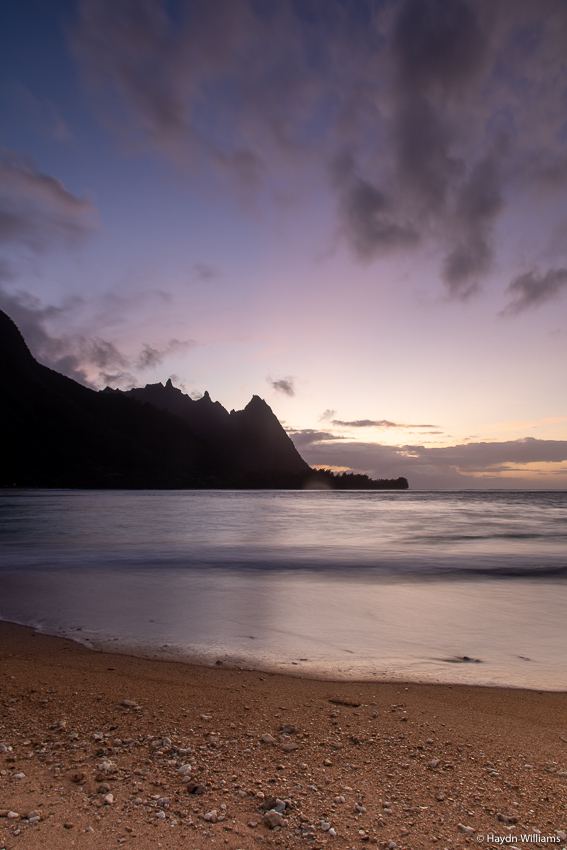
At this point, we were into our final evening of the trip, so obviously the weather decided to improve! The photographer in me finally awoke, and we rushed back around to Ha’ena beach before dinner to catch sunset. There were still some evil-looking clouds out to sea, but things were looking up in other directions.
© Haydn Williams 2020
© Haydn Williams 2020
After dinner, with the cloud vanquished almost entirely, I saw my first stars of the entire trip and managed to get a couple of shots from the beach before bed. Research had suggested that the galactic centre of the Milky Way would be below the horizon, this meaning that the brightest part wouldn’t be visible, but I’m pleased with the results nonetheless.
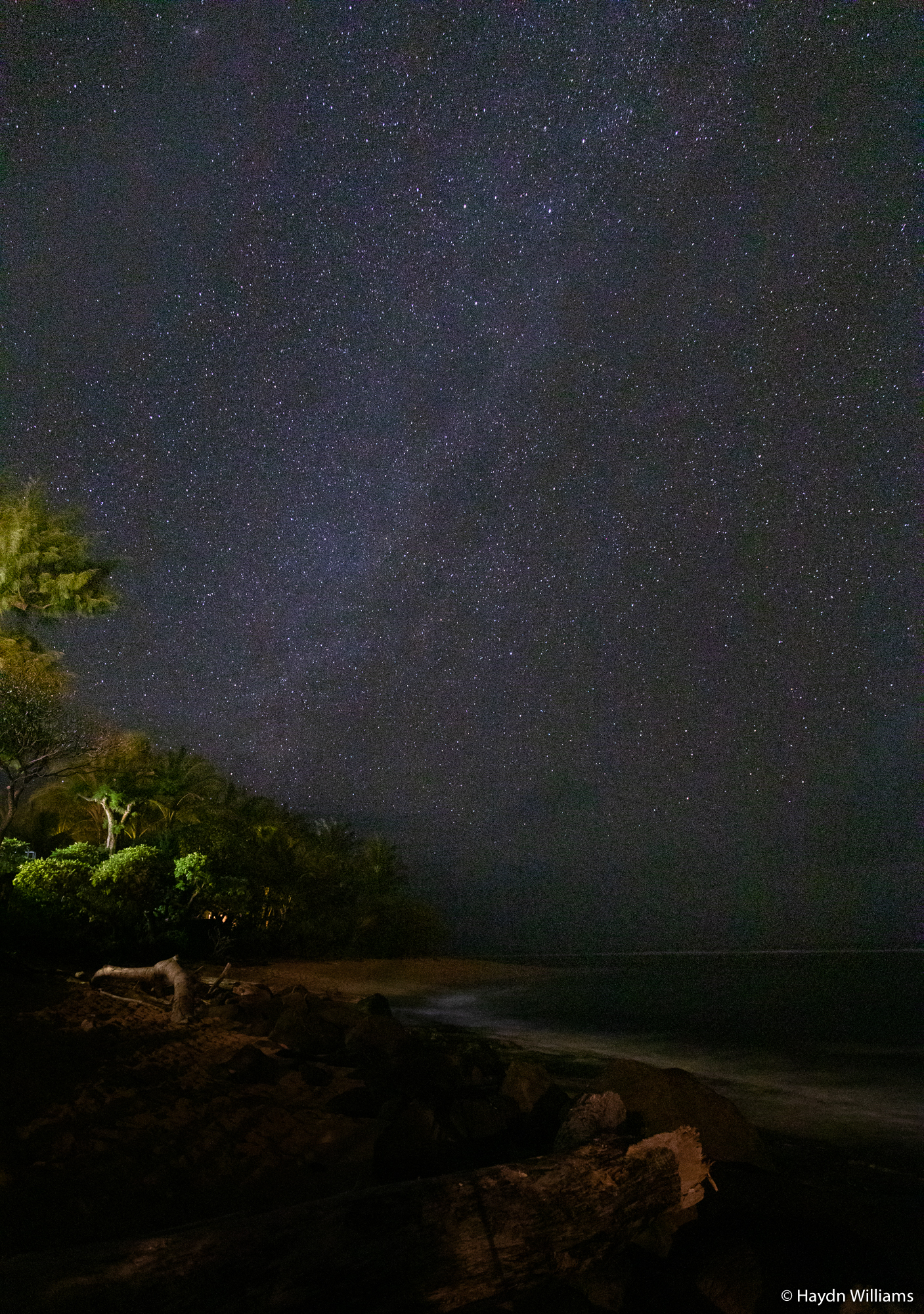
© Haydn Williams 2020
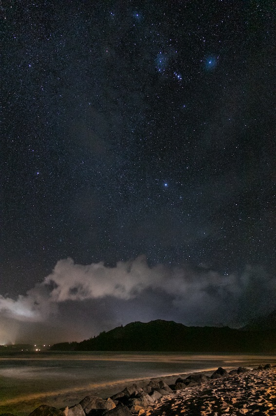
© Haydn Williams 2020
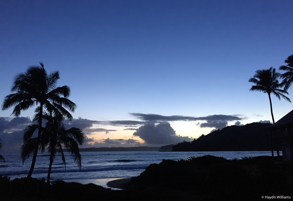
The following morning was another early start for the airport, but we caught sunrise from the apartment window before setting off. This was the first time I’d actually seen the sun during the entire trip, and even on the short drive to the airport it was amazing how much it changed the whole character of the island versus monochromatic cloud cover.
I hope this post hasn’t come across as too much doom-and-gloom about the weather – we undoubtedly missed a couple of spectacular views at Kīlauea and Napali, but we saw plenty of other things, and got loads done. We certainly couldn’t have packed any more in, and it was nice to be free of sunburn paranoia for the duration, too! I think the take-home message from this post is that there are absolutely loads of things to see and do in Hawai’i, so if you ever get the chance to visit then do your homework in advance. It’s so much more than just beaches! Also be prepared for the weather too – our first port of call, Hilo, experiences over 12″ of rain per month for four months of the year, and in July and August has an average of 28 rainy days per month! Variation is huge though – Kona, on the other side of the same island, has only two months where rainfall tops 3″. So pack for everything, and you’ll be fine!
1 thought on “Hawai’i”
No Comments